0502 · 0504 · 0506 · 0509

Geological & Groundwater Studies

G&G specialises in understanding and managing Earth's resources through advanced and innovative technologies — from locating sustainable aquifers to mapping rock formations and land use.
  • Groundwater Exploration — locating and assessing aquifers for sustainable water supply.
  • Geophysical & Geological Survey — subsurface property mapping and rock-formation studies.
  • Hydrogeological Survey — groundwater systems analysis for sustainable management.
  • Soil & GIS Studies — soil characteristics and spatial mapping of geology and land usage.
  • Topographical Studies — elevation and contour mapping for planning and resource management.
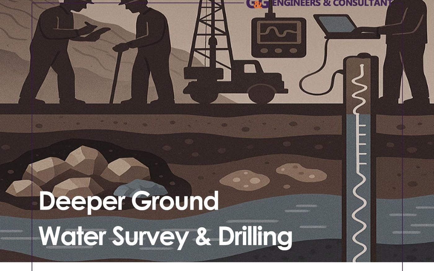
Deeper groundwater survey and drilling illustration
Major Groundwater Services
  • Piezometers & exploratory borehole drilling
  • Production wells & well-field designing
  • Deep & shallow well drill design and installation
  • Tube-well material supply & related services
  • Geo-electric resistivity surveys / ERT
  • GIS-based geospatial studies & groundwater modeling
  • Long and step aquifer yield tests
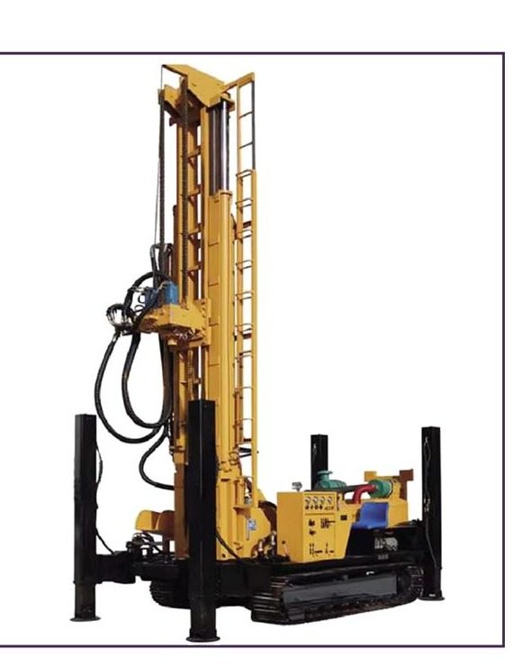
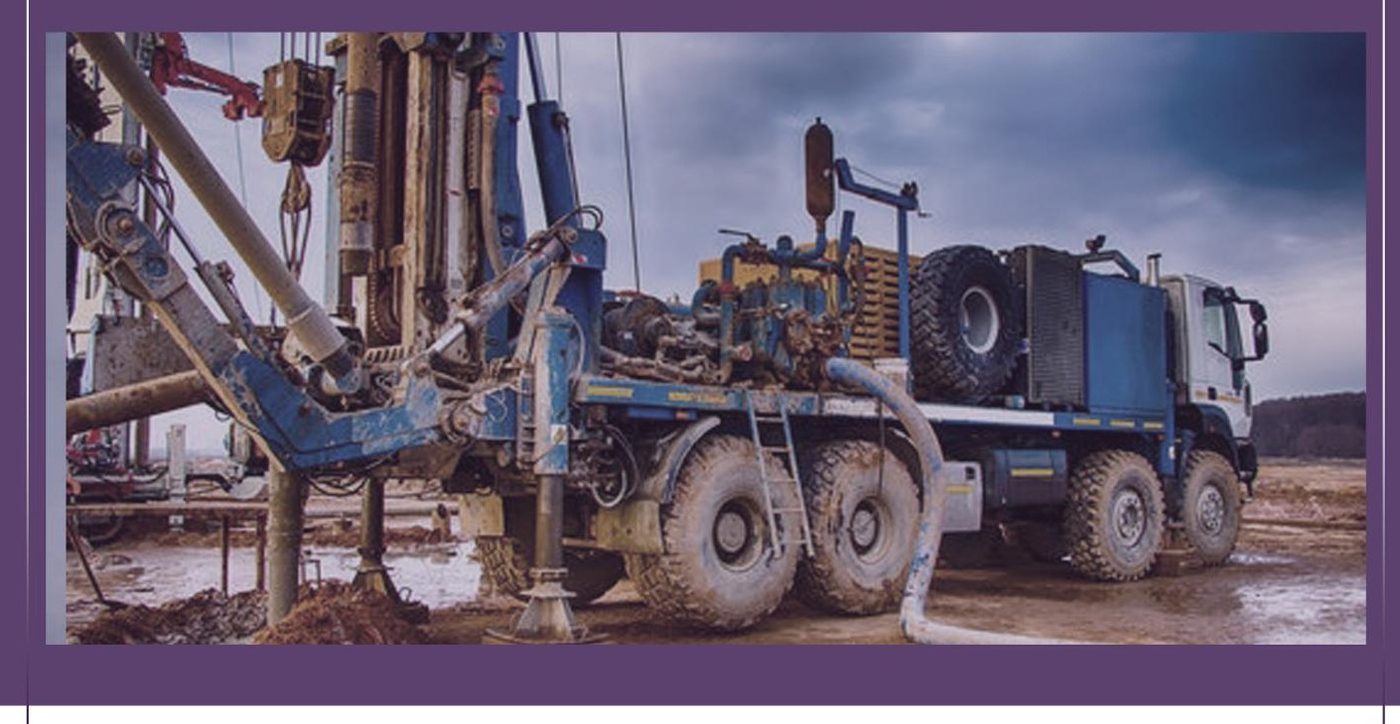
Deep drilling rig truck for test and production wells Diamond core drilling machine
Drilling & Coring

Drilling & Mining Services

Accurate resource extraction and analysis — from groundwater boreholes to deep diamond core drilling for mineral exploration.

  • Boreholes & Diamond Core Drilling — BQ, NQ and HQ diameters, depths to 1,500–2,500 ft.
  • Test & Production Well Drilling — installation, rehabilitation, cleaning and washing of boreholes.
  • Mineral Drilling & Testing — precise extraction techniques with in-field mineral property analysis.
  • Wireline Logging — optical/acoustic TV, spectral & natural gamma, induced polarisation, resistivity-DLL3, temperature & conductivity, impeller flowmeters, full-wave sonic, P&S logging, density & neutron porosity.
  • Full Tube-Well Material Supply — casing, screens, pumps and related accessories.
0503 · Geophysical Surveys

Geophysics for Mineral Exploration

A full geophysical toolkit for locating and characterising ore bodies and aquifers — surface, airborne and downhole.

2D / 3D

Induced Polarization & Resistivity

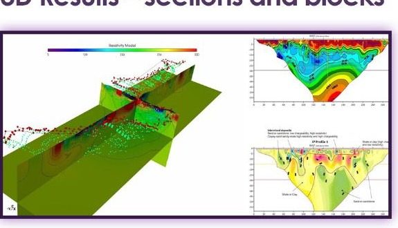
ERT, VES, ERT-IP and self-potential surveys; distributed 3D IP with up to 200 dipole measurements per injection.

Land / Aerial

Magnetometer Surveys

Land Mag (G859/G857 Rover), aerial Mag drone (DJI350RTK) and magnetic susceptibility (Kappameter).

Gravity

Gravity Surveys

CG6 gravimeters with high-temperature options up to 55°C, multiple units available.

Reflection / MASW

Seismic Surveys

Shallow seismic reflection to 500m depth, refraction, MASW, HVSR, ReMi and spectral analyses.

FDEM / TDEM

Electromagnetic Surveys

Frequency- and time-domain EM (DOI to 600m), plus downhole EM (DHEM) with the Digi Atlantis system.

AMT

Audio Magnetotellurics

Geode EM3D 2D/3D processing with joint inversion, up to 12 channels and 4 stations.

GPR

Ground Penetrating Radar

High-frequency (GSSI 3000/4000) and low-frequency PulseEkko systems for deeper penetration.

Radiometric

Spectral Radiological

RS330 / PGIS portable gamma-ray spectrometry for radiological and mineral surveys.
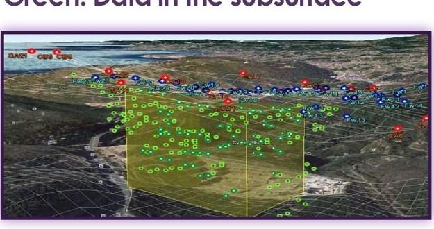
3D chargeability inversion block model from IP survey 3D geophysical inversion sections and blocks
0511 · 0532 · 0536 · 0537

Engineering & Feasibility Studies

Innovative, reliable engineering solutions supporting a project from concept through to execution.

0516

Technical Studies

Detailed evaluations to optimise project success.

0511

Feasibility Studies

Comprehensive assessment of project viability and cost-effectiveness.

0532

Structural Design

Safe and efficient designs for buildings and infrastructure.

0536

Soil Mechanics & Foundation

Soil-behaviour analysis and custom foundation solutions.

0537

Engineering Design

Tailored designs meeting all project-specific requirements.

0533

Urban Design

Functional and aesthetically considered urban spaces.

0575

Civil Work Rehabilitation

Restoration and rehabilitation of existing civil works.

Documentation

Reports & Scopes

Technical reports, tender specifications, scope of work and bill of quantities.

Licensed Testing Laboratory No. 29

Mineral–Geotech Soil Test Laboratory

ISO-compliant lab procedures, expert geologists and field engineers, quick turnaround with accurate, custom-reported data.

Mineral Testing

Ore Grade, Assay & Mineralogy

  • Ore grade & assay (Au, Cu, Fe, etc.)
  • XRF & XRD analysis
  • Petrographic & mineralogical studies
  • Geochemical analysis (rock, soil, sediment)
  • Elemental & contaminant testing

Applications: resource estimation, mineral identification, exploration targeting, feasibility studies, environmental compliance.

Geotechnical Soil Testing

Foundation & Site Suitability

  • SPT & borehole drilling
  • Soil bearing capacity tests
  • Atterberg limits, grain-size analysis
  • Compaction & moisture-content tests
  • Foundation design inputs

Applications: site suitability, structural design & safety, soil classification, construction planning.

Grain Size Analysis

Sieve analysis & hydrometer test.

Atterberg Limits

Plasticity and consistency limits.

Compressive Strength

Digital compressive strength hydraulic testing to ASTM standards.

Density & Direct Shear

Bulk/dry density and direct shear testing.

Mine Dewatering

Dewatering Services for Mines & Minerals

Dewatering is a critical process in mining operations, involving the systematic removal of groundwater or surface water to ensure a safe, stable and efficient working environment. We deliver precision-engineered dewatering solutions designed for the demanding conditions of mining and mineral extraction sites — from advanced geophysical site investigation through borehole design, wireline logging and casing installation, to submersible pump commissioning and aquifer performance testing.

Process
  • Preliminary site survey & hydrogeological assessment
  • Surface geophysical survey methodology selection
  • Geophysical data acquisition & interpretation
  • Water-well site selection & drilling setup
  • Subsurface geophysical wireline logging
  • Well bore casing design & installation
  • Submersible pump & riser pipe installation
  • Aquifer performance & recharge testing
GIS, Drone & 3D Modeling

GIS, Drone Surveys & Mineral Modeling

Geographic Information Systems streamline sampling, analysis and decision-making across a mining area — layering topography, geology, satellite imagery and mineral/chemical data into one working model.
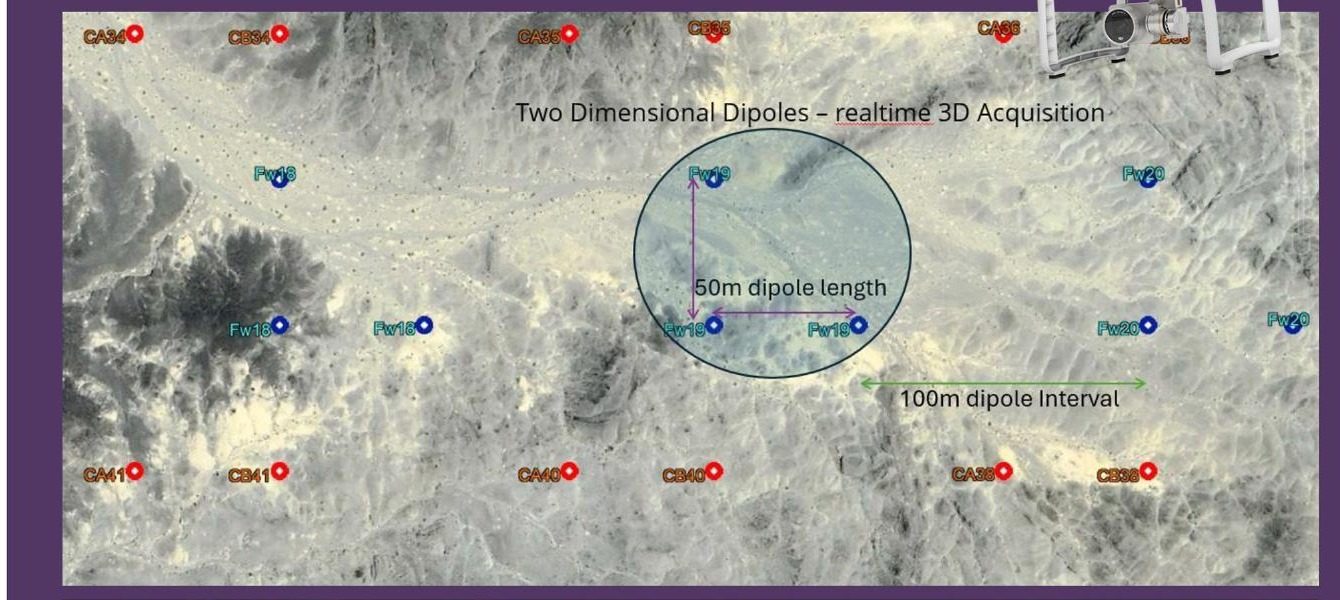
  • Drone Surveys — mobile mapping LiDAR, photogrammetry, conventional as-built survey.
  • Grid Sampling & Geostatistics — kriging-based ore grade prediction across sampled and unsampled zones.
  • Mineral Modeling — Leapfrog, Discover 3D and virGIS custom 3D modeling (RUNETTE, VR headset).
  • Site Monitoring — GIS-based tracking of sampling progress and environmental compliance zones.
GIS and drone-based survey grid over varying topography

Have a project brief ready?

Send Us the Scope →